Europe: Latest weekly models, issued Mon 19 – outlook for weeks 3 and 4
Posted on September 20, 2022 by Sarah Sammy
The latest ECMWF and GFS Weeklies below show a similar pattern of Atlantic Ridging being established to the northwest of the region, ridging into western mainland Europe from the north. The main difference between the two main models is in the extent of ridging in the north and the location of lower pressure over the northeast/central areas. Both models have shifted the weekly forecasts into October considering the shift in the shorter range forecasts over the weekend.
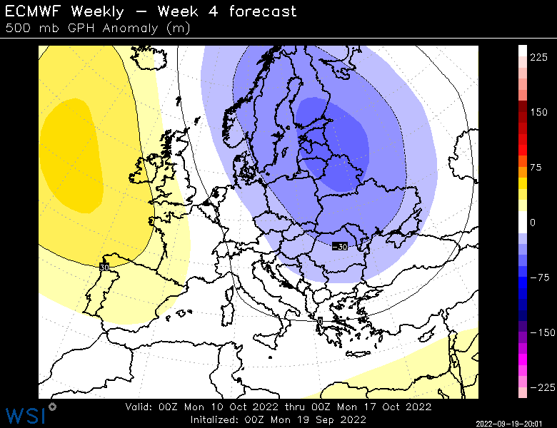
The latest ECMWF ENS now brings a more robust high pressure into the northwest of the region, ridging in to northwest parts of the British Isles in week 3 and potentially extending more widely into western mainland Europe through week 4. Lower pressure over Scandinavia with troughing into northeastern parts of the mainland remains consistent through weeks 3 and 4 with the troughing in week 4 ridging more extensively over eastern Europe. In week 3, this pattern brings cooler anomalies into central and western mainland Europe, with warmer anomalies into Turkey. Through week 4, the cooler anomalies transition further eastward bringing coldest anomalies into central to eastern mainland Europe, with the far west beginning to see anomalies edging above the seasonal average once more. In terms of winds and precipitation expectations, the main inputs for week 3 will mainly be from Scandinavia to northwest Russia as incoming low pressure sinks southward around the high to the west before moving eastward across northeast mainland Europe/S’rn Scandinavia/Baltic Sea region. Although in week 3 lower pressure may edge into southwest mainland Europe, but by week 4 the more extensive ridging would bring drier conditions there.

The latest GFS weekly has higher pressure in the northwest as well as extending into northwest Russia with ridging widely across the north while lower pressure is centred over the central mainland. In general this is a lower wind power potential pattern for the northern wind farms than the ECMWF weekly for both weeks. In terms of precipitation, lower pressure over the eastern to central continent will bring enhanced precipitation to that region. In terms of temperature anomalies however, both week 3 and week 4 patterns in the GFS weekly keep warmer anomalies into the mainland more widely.
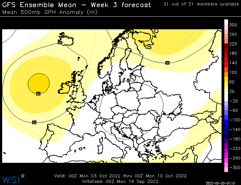
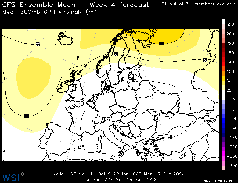
Overall both models have shifted in response to the pattern change anticipated within the week 2 period. Both models continue to have higher pressure to the northwest of the region with Atlantic ridging being the main feature of the forecast. However, in terms of temperature anomalies, the differences in patterns over the northeast/Scandinavia and into central Europe bring widely different outlooks between the models. The ECMWF keeps cooler anomalies in the northerly flow while the GFS entrains warmer air around the lower pressure over central to eastern Europe, and the ridging to the north cuts off the northerly flow of cooler air there. In terms of precipitation, both models bring increased input to eastern Europe with the GFS bringing a drier outlook for Scandinavia as compared to the ECMWF.
Posted in Europe Medium Range | Comments Offon Europe: Latest weekly models, issue.